
Exploring The Genesee River
The Genesee River runs for 12 miles through Rochester, from Genesee Valley Park to Lake Ontario.

The 157-mile Genesee River originates 10 miles south of the Pennsylvania border. As it flows north, it passes over Letchworth’s three major waterfalls and meanders through several towns, including Mount Morris, Geneseo, Caledonia, Avon, Rush, Scottsville, Chili, and Henrietta. At Genesee Valley Park, the river merges with the Erie Canal and continues north through Rochester, flowing over Court Street Dam and High, Middle, and Lower Falls before reaching Lake Ontario.
The Genesee River is often mistakenly thought to be a rare example of a river flowing north. However, several north-flowing rivers, including the Niagara and Oswego Rivers, are within an easy day trip from Rochester, and dozens more are found within New York State. Nevertheless, the Genesee is the only river that flows across the entire state of New York.
Major Trails
Genesee Riverway Trail
The GRT is a 24-mile National Recreation Trail that runs alongside a 12-mile stretch of river through Rochester’s urban corridor. This trail is a great way to explore the city’s scenic, historic, and cultural areas. It begins at Lake Ontario and travels south through Turning Point Park, Seneca Park, Maplewood Park, the High Falls Historic District, Corn Hill, and the University of Rochester, concluding in Genesee Valley Park. Along the way, the GRT crosses eight bridges and three waterfalls. Although it is mainly paved and dedicated, some areas are steep and narrow, or require the use of streets, particularly in the city center. The GRT connects with the Genesee Valley Greenway Trail and Erie Canalway Trail in Genesee Valley Park, making the park a great starting point for a hike or bike ride.
Genesee Valley Greenway
The greenway—also a designated National Recreation Trail—passes through Scottsville and Rush in Monroe County. It then goes through Caledonia, Avon, Geneseo, Mount Morris, Letchworth State Park, and Portageville in Livingston County, and finally ends in Cuba in Allegany County. At Wadsworth Junction in Scottsville, you can connect with the Lehigh Valley Trail, which features a unique trestle bridge crossing the Genesee River.
City of Rochester
The Genesee River runs for 12 miles through Rochester, from Genesee Valley Park to Lake Ontario.


Austin Steward Plaza at Genesee Crossroads Park
The newly renovated Austin Steward Plaza (formerly Major Charles Carroll Plaza), completed in July 2024, links Main Street with Andrews Street. The pathways, including a footbridge over the river, are designed to accommodate visitors using wheeled transportation methods, such as wheelchairs, strollers, bicycles, and skateboards. Additionally, seating areas are provided for individuals to enjoy a peaceful moment by the river. 69 Andrews Street
Corn Hill Landing
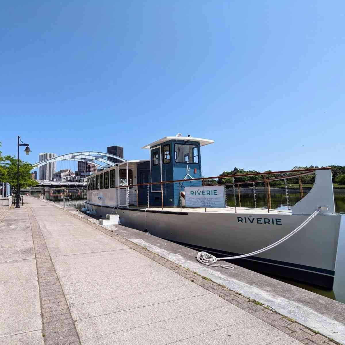
Corn Hill, Rochester’s oldest residential neighborhood, boasts impressive examples of early architecture and some of the city’s original homes. Take a river cruise on board the Riverie from the Corn Hill Navigation waterfront center. The area features several restaurants with waterfront seating. Exchange Blvd

Genesee Valley Park
Genesee Valley Park (GVP) was designed by Frederick Law Olmsted in 1888. Located where the Erie Canal, Red Creek, and Genesee River intersect, the park offers visitors the opportunity to rent kayaks and canoes from the Genesee Waterways Center. The park features four beautiful concrete footbridges that connect the park across each waterway. Initially, the Erie Canal ran through Rochester over an aqueduct, which is now the Broad Street Bridge. In 1918, the state altered the canal route to follow the city’s southern border through Genesee Valley Park, resulting in the addition of the bridges. 1000 E. River Road

High Falls
The area known as High Falls includes the waterfall, a historic district, and the future site of Rochester High Falls State Park. Popular spots to view the falls from the northeast include High Falls Terrace, the Pont de Rennes Bridge, and Genesee Brew House’s rooftop patio while enjoying a casual meal and a tasty beverage. Visitors can stroll along cobblestone streets on the west side of the river to explore the area’s hydropower history and catch a glimpse of the falls near the Gorsline Building’s viewing terrace. 4 Commercial Street
Learn more about the proposed state park at High Falls.
High Falls on the Genesee River

Maplewood Park
The two-mile linear Olmsted-designed park runs alongside the river, stretching from Middle Falls to Kings Landing, the oldest cemetery in Rochester. It begins at the Maplewood Rose Garden in Lower Maplewood, where many visitors start their walk by descending the stairs to access the Genesee River Trail. As you walk upstream, you’ll come across Lower and Middle Falls. Heading downstream will take you through Middle Maplewood and along Seneca Parkway, also part of the park system designed by Olmsted. Passing under the New York State Route 104 Veterans Memorial Bridge, the trail continues into Upper Maplewood and ends at the Pure Waters Pedestrian Bridge, which connects to Seneca Park.
This area, known as Casconchiagon—River of Many Falls—was once the site of a Seneca Nation village until 1819.
Kelsey’s Landing became a terminus for the Underground Railroad after the Fugitive Slave Act of 1850 was passed by Congress. Boats would dock here and guide freedom-seeking African Americans, including Frederick Douglass in 1859, to safety across Lake Ontario to Canada.

Ontario Beach Park
At the northernmost tip of the city, the Genesee River borders the park to the east. Besides a sandy beach with plenty of parking, visitors can enjoy a leisurely stroll on the boardwalk and pier, indulge in the original 1902 Abbott’s Frozen Custard, ride on the 1905 Dentzel Carousel, and tour the 1822 Charlotte-Genesee Lighthouse. 50 Beach Avenue
Continue reading on daytrippingroc.com
